Showing posts with label Aerial Photos. Show all posts

Saturday, July 13, 2024

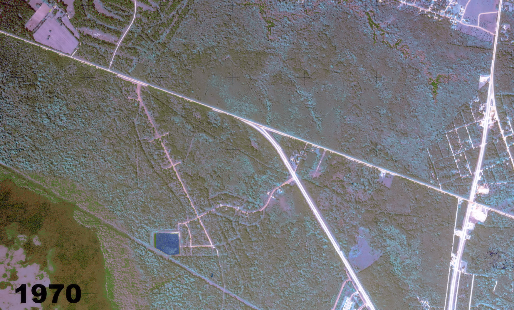
Covington 1970

 Here's an aerial photograph of the Covington area taken in 1970. Click on the image to make it larger. 


Monday, June 6, 2022

The 1973 Overview

 In 1973 I wrote a newspaper column describing the growth of the Mandeville area, primarily the new developments that were pushing its boundaries westward further along La. Hwy. 22 towards Madisonville. The column mentioned several of the factors that were horrifying St. Tammany residents of the time, namely the "Veterans Highway" look and feel, the rising price of gasoline, and the environmental concerns that were just making themselves known.


West Causeway Approach and Hwy. 22 in 1970

The following column was written some 50 years ago. 


Click on the image above to make it larger and more readable. 


In 1972 the beginnings of Beau Chene


1974


1976


2021 - Image Source: Google Earth

Text of the above newspaper column:

 Tammany Talk by Ron Barthet

I was driving along from Madisonville to Mandeville last week when I noticed a small green sign on the side of the road. It said: "Mandeville— corporate limits." And my reaction was: what's that doing way out here?"

Well, the truth is, the west end of Mandeville is now out that way, taking in a lot of those new subdivisions going up out there. There's all kinds of activity going on, with the clearing of trees, leveling of streets and such.

Beau Chene, the new subdivision fronting the Tchefuncte River, is coming along well, and Beau Rivage across the way is sporting a new entrance plaza that makes it quite attractive.

The grounds of Mariner's Village are methodically being cleared and levelled for the condominium and harbor complex planned there.

Yes, the land along West Causeway Approach and La. 22 west of Mandeville is virtually one of the fastest growing sections of St. Tammany Parish, which is, in itself, one of the fastest growing parishes in the state.

It won't be long, I think, before that strip will have its own community grocery stores, filling stations and other commercial outlets.

The energy crisis probably won't stop the flow of New Orleans folks to St. Tammany Parish, but it might dampen the movement of city folks to St. Tammany rural areas such as Folsom and Goodbee. With the price of gasoline going up, commuters may find it more convenient to live near the north end of the Causeway than live somewhere else in the parish. 

That means even better growth in the area sitting near the Causeway, especially along West Causeway Approach, which is still relatively unpopulated.

If care is taken by residents and planners alike, the Causeway approach can avoid that "Veterans Highway" look that so many people are concerned with. Fortunately West and North Causeway Approach do not have drainage canals running down the middle of them.

Veterans Highway serves a useful purpose in New Orleans, providing the people of Metairie and Kenner with a central "business and commercial" artery. It doesn't serve as a main entrance into Metairie or Kenner, however.

On the other hand, West Causeway Approach, and North Causeway Approach, do serve as entrances to St. Tammany Parish. Their influence is two fold, one of important community traffic arteries and one of a gateway to western St. Tammany Parish. This should be kept in mind as their residential and commercial development continues.

End of column

I remember buying gasoline in 1971 at 25 cents per gallon. 


Saturday, May 21, 2022

The Covington Bypass

In the 1950's there was an airport north of Covington, around where McDonalds is now. It was called the KP Airport. Here's a 1954 map showing the airport. 


A 1954 topographic map

 Here are three aerial photographs, the first taken in 1952, the second the same but with landmarks labeled, and the third taken last year, showing the Covington Bypass, where U. S. 190 loops around through Collins Blvd to the beginning of La. 25, and then heads west towards Hammond. Click on the images to make them larger. 


The Covington Bypass 1952 


Notice the airport runways at the top, middle. At the bottom of the picture is the train track split where one track went off to the left to Hammond and the other went northward to Folsom in earlier days


In 1955 the contract was let for the bypass highway

Then 70 years later....


Google Earth Photo

Here's a video that fades from one picture to the other...


Click on the play triangle to start video.

See also:

Poole Lumber Aerial Photo in 1974

Sunday, March 27, 2022

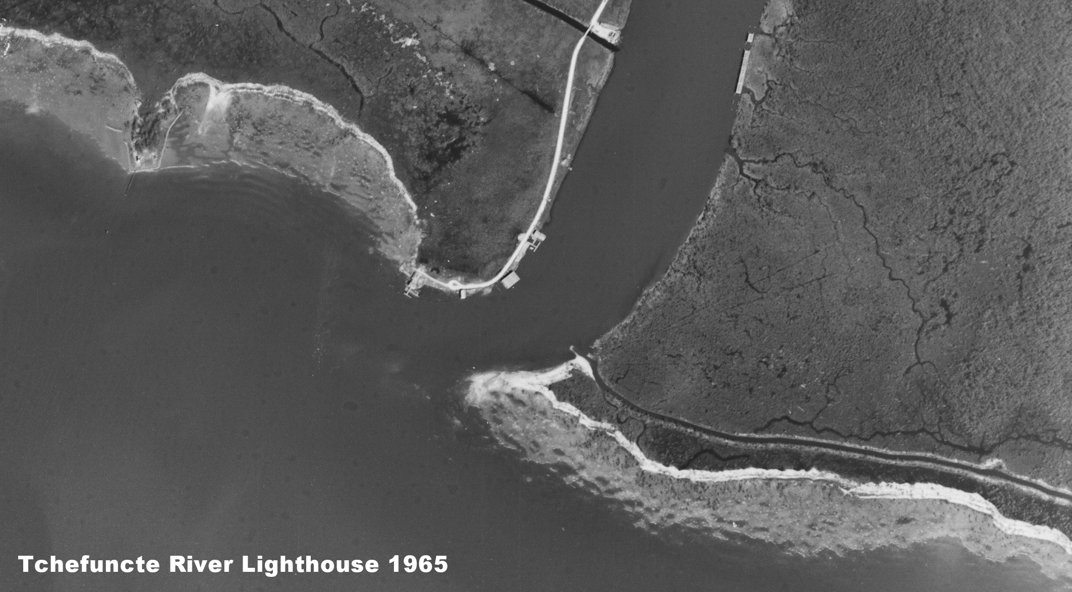
Lighthouse Aerial Photo 1965

 Here's a black and white aerial photograph of the lighthouse and boat launch at the mouth of the Tchefuncte River south of Madisonville in 1965. Click on the image to make it larger. 


Wednesday, January 5, 2022

The Filmore St. Bridge

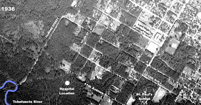
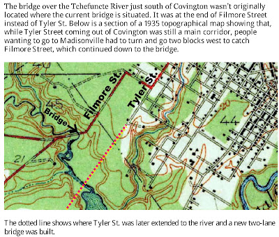
 In this 1936 aerial photo of the southern portion of Covington, we see the bridge going over the Tchefuncte River at the end of Filmore Street. The section of Tyler Street from 11th Avenue to the river had not been cleared of trees yet, and the future location of St. Tammany Parish Hospital was also still just trees. The hospital would be built there twenty years later. 

 
Click on the image to make it larger

Jahncke Avenue, shown at the lower right, passed by St. Paul's School and went on down to Old Landing. 

The need for a new bridge was discussed by the Covington town council at an August 1936 meeting. 


The bridge across the river at Filmore Street served as Covington's link to the road leading to Madisonville. In the 1800's, an earlier road branched off of Old Landing Road and met up with a ferry across the Tchefuncte River which allowed travelers to head on down to Madisonville. 


Saturday, May 16, 2020

Aerial Photo of Lacombe 1970

Thanks to NASA, we have this high-altitude photograph of Bayou Lacombe taken in February of 1970. The original was an infrared photo that showed the trees as orange-red, but I have adjusted the hue to make it look like more natural colors. Click on the image to make it larger. 


Thursday, August 22, 2019

Aerial Drone Photography of Slidell

Interesting aerial drone photography of Slidell and other St. Tammany locations were recently produced by ecko360 Media for the home pages of several ShopLocalUSA.com community pages. 

Here is a link to the video shot by the company showing downtown Slidell. Click on the "play triangle" to start the video, then click on the [ ] in the bottom right corner to enlarge the view. 


Downtown Slidell

 
See also:

Aerial drone photography of Covington, Abita Springs and Madisonville

Saturday, August 10, 2019

Aerial Drone Photography By ShopLocalUSA

The "ShopLocalUSA.com" website has some new aerial drone video of Covington, Madisonville and Abita Springs. Here are the links,  click on the "play triangle" to start the video, then click on the brackets [ ] in the lower right corner to enlarge the viewing area.

Covington


Abita Springs


Madisonville


The videos were done by Ecko360 Media. Their YouTube channel is located AT THIS LINK.

Thursday, June 20, 2019

Lacombe - 1981

Here's an aerial photo of the Lacombe area taken in 1981.


Click on the image to make it larger. 

Tuesday, March 5, 2019

Aerial Photo of Beau Chene - 1965

Here is an aerial photo of the area which was to be Beau Chene subdivision between Mandeville and Madisonville. The photo was taken in April of 1965 and shows La. Hwy. 22 and its junction with West Causeway Approach. Click on the image to make it larger. 


The Tchefuncte River is in the upper left corner, and Covington Country Club is in the upper right corner.  

See also:

Beau Chene Subdivision History


Tuesday, November 27, 2018

Folsom Aerial View - 1954

Here is an aerial photograph of the Village of Folsom taken on February 24, 1954. Click on the image to make it larger. 


Here's an even closer view.


Friday, October 5, 2018

Aerial Photos of Madisonville in 1965

Some 53 years ago some high-resolution aerial photos were taken of Madisonville. Here they area. Click on the images to make them larger. 


Sunday, September 2, 2018

Madisonvillle Boat Festival Aerial Video

Here is a video combining several still aerial photographs of a Madsionville Wooden Boat Festival from a few years back. Click on the play triangle in the middle of the picture to run the video, then click on the "full screen" icon in the lower right corner to enlarge the view. 


Wednesday, August 22, 2018

Timeline Aerials of I-12/La. 21 Intersection

Using the timeline feature offered by Google Earth's aerial photography, we can watch the commercial construction around the Interstate 12/La. Hwy. 21 intersection near Covington from 1918 to 2018, twenty years. 

La. Hwy. 21 from Covington to Madisonville crosses the frame vertically, and Interstate 12 crosses the frame from left to right on a slight incline. The Target shopping center comes in first, then the Oschner Clinic, then the Kohl/Academy shopping center, followed by the residential subdivisions and apartment complexes in the lower right. 


Click on the play triangle in the center of the window, then click on the full screen icon at the bottom right.

Tuesday, August 7, 2018

Aerial Picture of Mouth of Tchefuncte River

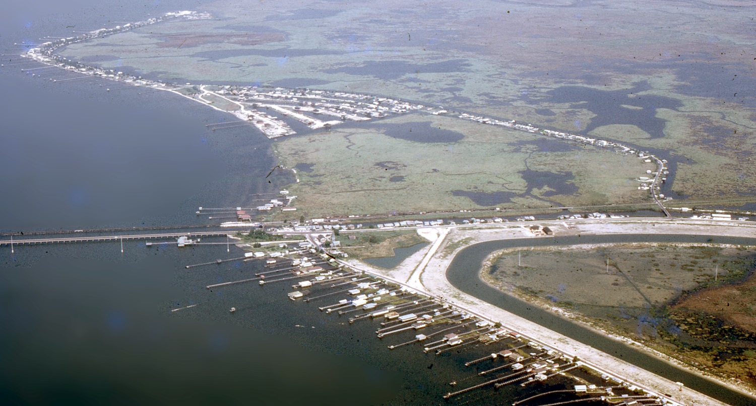
This picture was taken by Richard Warner in 2010, showing the mouth of the Tchefuncte River at Lake Pontchartrain, the view towards the east. It includes the historic lighthouse, the boat launch, and the T-Rivers Bar and Grill.


Click on the images to make them larger. 

Wednesday, July 25, 2018

Aerial Photos of St Pauls School Campus

Here's an aerial photo of the campus of St. Pauls School in Covington in the 1930's...


Click on the images to make them larger.

Here is a picture from the 1960's


1963


1965


1975

Below is a 2018 screenshot of Google Earth image showing St. Paul's campus

Wednesday, July 4, 2018

Aerial Pictures from the Past

Over the past two years, I have posted a variety of aerial photos that I took during airplane flights in the 1970's and 1980's over St. Tammany Parish. I thought a consolidation of the more popular ones would be interesting, so here they are, listed in alphabetical order by community name.

There are a few photos that I didn't take, and those are marked accordingly. 

Click on the images to make them larger. 


Abita Springs 

1975


Close up


1972


Click on the images to make them larger. 

 Barkers Corner


Bennett Bridge Road, a mile west of La. 25, 1975


Bush
Before the new highway continued on to Talisheek


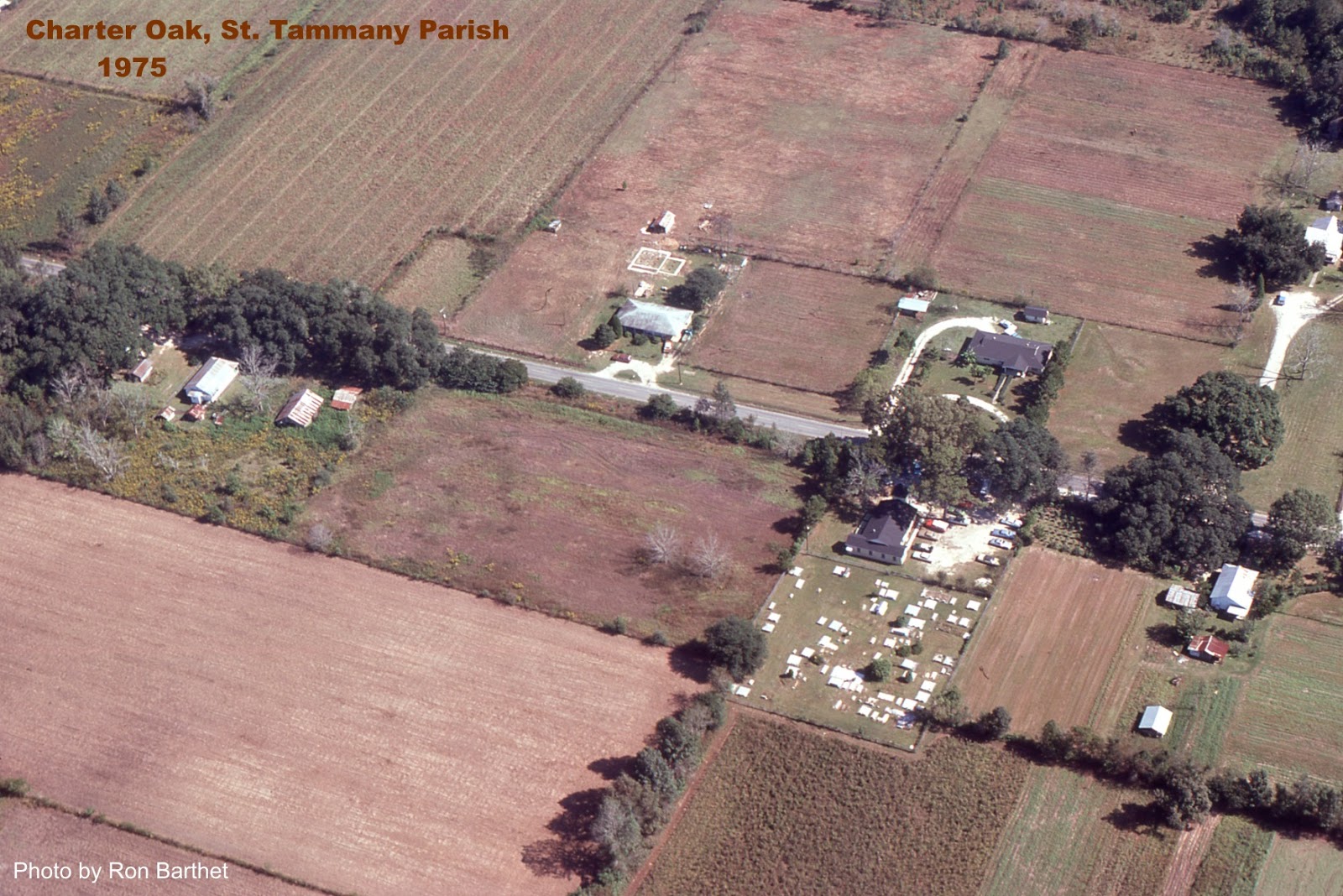
Charter Oak


Covington

The east entrance on Boston Street in 1975


Click on the images to make them larger. 


Covington High 1976


1976


 1972 


Claiborne Hill 1975


Above photo from the La. Dept. of Transportation


Photos by Ron Barthet


Claiborne Hill Close Up


St. Paul's School


Parish Fairgrounds around 1975


Parish Fairgrounds around 1980


Below image shows the Parish Fairgrounds prior to 1980. Notice Lyon Elementary at the bottom, the baseball fields still on Columbia Street, the National Guard Armory on the corner, the Covington Community Center facing Columbia St. and the Holy Family Catholic Church on the extreme left edge.


Below is the view looking eastward at the Hwy. 25 and Collins Blvd. intersection in 1975. The big white building is Poole Lumber Co. The picture is interesting for what it does not show, things that haven't been built yet: the St. Tammany Parish Jail, the Winn Dixie Supermarket and shopping center, the Shell Service Station, drug stores, Wendy's, Burger King, McDonald's, with no residential subdivisions in the far distance.


Click on the images to make them larger. 


View looking westward on Interstate 12 (under construction) with U.S. 190 running horizontally across the frame, left side going to Mandeville. The Jet Drive In visible on the right.


Photos by Ron Barthet


Dorignac's Farms, Old Military Road, 1975


Evans Creek


Goodbee

View looking southwest at intersection of U.S. 190 and La. 1077, with the "Country Boy One-Stop" grocery store pictured.


Fairhaven Children's Home


Folsom

View looking northeast at the La. 25 and La. 40 intersection. The old town hall is located just above the intersection. It was later moved west one block to the gravel road in the lower lefthand corner.


The Broken R Ranch east of Folsom


Fontainebleau State Park


Fontainebleau Park looking towards causeway over lake


Goose Point


Hickory


Lacombe


Lacombe Marsh 1975


 Madisonville

1972


Click on the images to make them larger. 


The old community house can be seen in the above photo

 1975


 View looking southward towards Lake Pontchartrain


Equitable Shipyards 1975


 Close up


Wooden Boat Festival 


Click on video below to see more boat festival pictures. 


Marina Beau Chene


Beau Chene Golf Course


Mandeville


Mandeville Harbor


Click on the images to make them larger. 


A little closer


Girod Street (back when it was Gerard St.)


View looking southward at U.S. 190 and Girod Street intersection in 1975. U.S. 190 runs horizontally across picture. Library in upper middle. 


Mandeville Junior High


Prestressed Concrete Plant


La. 22 at North Causeway, K-Mart bottom right


Pearl River
 Here is an aerial photograph of Pearl River taken in 1975, with the view looking west. Pearl River High School is seen in the lower center of the picture. Click on the image to make it larger. 

Downtown Pearl River 1975


Click on the images to make them larger. 


Sixth Ward Junior High


 A lock on the Pearl River Navigational Canal


Slidell

Gause Blvd. looking west from I-10 towards Front Street.


Front Street, view looking northward, with train depot near top of frame across from two-story red building (now the Chamber of Commerce). 


View looking southward towards Gause Blvd., with the water tower and Slidell High School in upper right.


The Tiger Drive-In Movie Theater


 Slidell Northshore
Carr Drive at top


The Village of Sun


Talisheek


Waldheim


Many of the above aerial photographs were taken with the help of Howard Estes, a local pilot who volunteered to take me up in the air to take pictures of St. Tammany Parish every so often. Click on the article below for details: