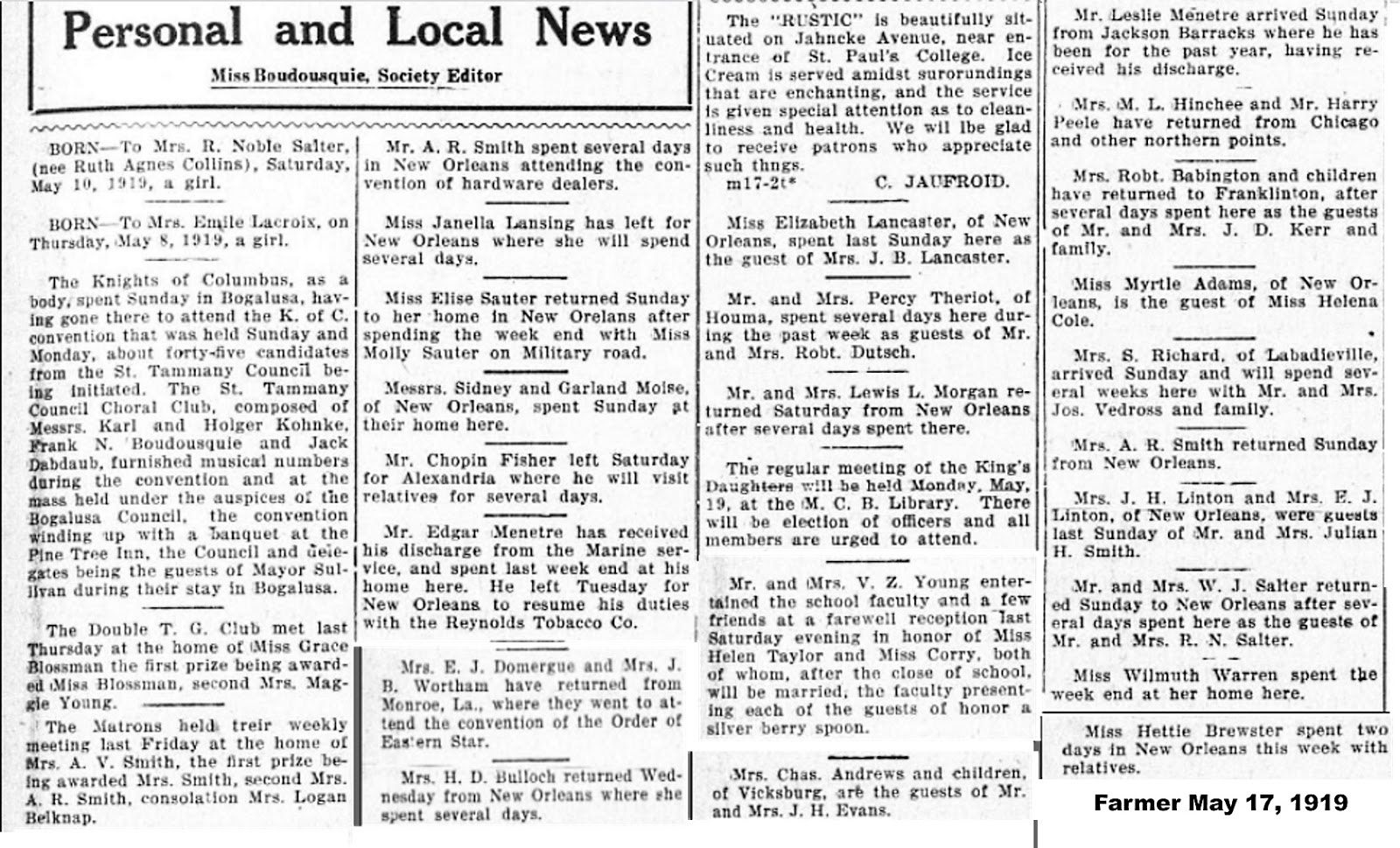
What was going on 100 years ago this week? CLICK HERE for a link to the St. Tammany Farmer of May 17, 1919. The link is provided by the Library of Congress and its Chronicling America service.
Weddings, festivals, canning, bicycles, and society news.
Click on the sample images below to see larger versions.
Friday, May 17, 2019
Thursday, May 16, 2019
Early Map of Lewisburg
This 1834 map of Lewisburg(h) was recently purchased at an Antiques & Uniques sidewalk show at the Covington Trailhead.
In the bottom right corner of the 1834 map, it indicates that the plat was mapped out by S.F. Lewis, C.E.
CLICK HERE to see an enlarged version of the map.
An interesting thing to note on this early subdivision plat is that at the northern end of Fountain Avenue the word "fountain" is marked close to the boundary of the flood plain of Chinchuba Bayou, near the intersection of Cedar Avenue and Fountain Avenue. Today there is no Cedar Avenue coming off of Live Oak Avenue.
The block on the map stretching between Elm and Cedar Avenue also doesn't show up on maps of today. Another street shown on the subdivision plat that is no longer there as well is "Lake Avenue," which was to run along the shoreline of Lake Pontchartrain. It was either never built or was eroded away into the lake after a few hurricanes.
A 940 foot pier that was shown jutting out into the lake between Mulberry and Hickory Streets on the 1834 map was labelled "Rail Road." This may have been the pier that figured prominently in the Civil War (it was burned to prevent Union ships from docking).
Later in the 19th and early 20th century, Lewisburg piers were favorite passenger dropping off spots for the many lake schooners that made regular trips from New Orleans to Madisonville and beyond.
In the bottom right corner of the 1834 map, it indicates that the plat was mapped out by S.F. Lewis, C.E.
A 1876 "True Copy" made of the original map
While there is no "Oak Lane" on the 1834 map, there is an Oak Lane today in between Fountain and Magnolia Streets. On a"True Copy" of the original map that was drawn in 1876 (shown below) the path of Oak Lane was shaded in gray.
The pier out into the lake was no longer being shown on the 1876 map. This black and white version came from the files of historian Donald J. Sharp.
To see an enlarged version of the "True Copy" map from 1876,
See also:
Google Maps View of Lewisburg
Covington High 1925 Graduation Booklet
Here are several pages from the 1925 graduation booklet for Covington High School commencement exercises. Click on the images to make them larger.
Source: Mary Ann B. Fontenot on the Remember Covington..the way it was..way back when Facebook Page
Wednesday, May 15, 2019
Admiral Farragut Helps The Choctaws
According to information discovered by historian Donald Sharp, the famous Admiral David
Glascow Farragut of the United States Navy once aided the Choctaws of St.
Tammany Parish at the request of Father Rouquette.
Admiral Farragut came to the aid of the Choctaws of St. Tammany Parish during the period of military occupation of New Orleans. Adrien Rouquette had met Farragut on a trip up north years before the War. His nephew, James Rouquette (Dominique's eldest son) had sailed with Farragut on a mission which took him around the world by sea.
Pere Rouquette, after the burning of Buchuwa Village, sent an urgent appeal to Admiral Farragut for permission to cross Lake Pontchartrain to bring much needed medicine, food and clothing to The Nook for his suffering Indians. Farragut responded by sending a Federal gunboat up Bayou Lacombe to escort the Choctaw missionary to New Orleans and back to Lacombe.
Admiral Farragut came to the aid of the Choctaws of St. Tammany Parish during the period of military occupation of New Orleans. Adrien Rouquette had met Farragut on a trip up north years before the War. His nephew, James Rouquette (Dominique's eldest son) had sailed with Farragut on a mission which took him around the world by sea.
Pere Rouquette, after the burning of Buchuwa Village, sent an urgent appeal to Admiral Farragut for permission to cross Lake Pontchartrain to bring much needed medicine, food and clothing to The Nook for his suffering Indians. Farragut responded by sending a Federal gunboat up Bayou Lacombe to escort the Choctaw missionary to New Orleans and back to Lacombe.
(Photo courtesy National Archives)
According to Wikipedia, Farragut was the first rear admiral, vice admiral, and admiral in the United States Navy. "He is remembered for his order at the Battle of Mobile Bay usually paraphrased as "Damn the torpedoes, full speed ahead" in U.S. Navy tradition."
"Born near Knoxville, Tennessee, Farragut was fostered by naval officer David Porter after the death of his mother. Despite his young age, Farragut served in the War of 1812 under the command of his adoptive father. He received his first command in 1824 and participated in anti-piracy operations in the Caribbean Sea. He served in the Mexican–American War under the command of Matthew C. Perry, participating in the blockade of Tuxpan. After the war, he oversaw the construction of the Mare Island Naval Shipyard, the first U.S. Navy base established on the Pacific Ocean."
See also:
Tuesday, May 14, 2019
Madisonville's Fort Oak
Historian Don Sharp has researched the stockade fort that was built northeast of Madisonville.
Fort Oak 1813-1822
St. Tammany Parish had a fort of its own, located just northeast of Madisonville. It was built in the fall of 1813 by order of Governor W.C. Claiborne and Navy Capt. John Shaw.
After hearing about the Native American uprising leading to the massacre of Fort Mims in Alabama, the residents of Madisonville convinced the Governor and local Navy officials that a fort was needed. The local inhabitants and the workmen on the "blockship" at the nearby Naval yard would build the structure. We do not know its size or configuration, but there were 150 workers and at least 50 area inhabitants.
It was a "stockade" fort, meaning it was built with posts in the ground, with parapets on each corner to fire the cannons. Lt. Michael Carroll was in charge of the construction. It was under the command of Captain John Shaw, who placed a Marine guard with heavy cannon in the fort. It was located near where the Otis House in Fairview Riverside State Park is today, and stood from 1813 to about 1822 when the Marine guard was taken out.
Click on the images to make them larger.
How It Came To Be
The residents of Madisonville petitioned Governor Claiborne for protection from the Indians, and he and Captain John Shaw of the U.S. Navy made a special trip to Madisonville to meet with the community leader David Bannister Morgan and Rene Baham, who was part of the meeting.
Gov. Claiborne's plan for protection was to build a fort on the east side of the Tchefuncte River opposite the village and have a supply of rifles and gunpowder on hand in the fort for the inhabitants.
In addition, Capt. Shaw would place several cannons with a detachment of Marines. Shaw stated he had no doubts that he could defeat any band of Indians that would attack the area.
Where to place the fort? This is where David Morgan came in. With his knowledge of the area by his surveying in 1804 and 1812, he drew a map as to the selection of what he thought would be the best location. (See map).
Where was "Fort Oak" located? It had to be in a clearing due to the cannons placed by Capt. John Shaw. The clearing would give the cannons a clear field of fire. The only clearing between the Naval facility and Madisonville was near Jacques Lorreins house, (near where today's Otis House is) on the east bank of the river, opposite Madisonville.
After hearing about the Native American uprising leading to the massacre of Fort Mims in Alabama, the residents of Madisonville convinced the Governor and local Navy officials that a fort was needed. The local inhabitants and the workmen on the "blockship" at the nearby Naval yard would build the structure. We do not know its size or configuration, but there were 150 workers and at least 50 area inhabitants.
It was a "stockade" fort, meaning it was built with posts in the ground, with parapets on each corner to fire the cannons. Lt. Michael Carroll was in charge of the construction. It was under the command of Captain John Shaw, who placed a Marine guard with heavy cannon in the fort. It was located near where the Otis House in Fairview Riverside State Park is today, and stood from 1813 to about 1822 when the Marine guard was taken out.
Click on the images to make them larger.
How It Came To Be
The residents of Madisonville petitioned Governor Claiborne for protection from the Indians, and he and Captain John Shaw of the U.S. Navy made a special trip to Madisonville to meet with the community leader David Bannister Morgan and Rene Baham, who was part of the meeting.
Gov. Claiborne's plan for protection was to build a fort on the east side of the Tchefuncte River opposite the village and have a supply of rifles and gunpowder on hand in the fort for the inhabitants.
In addition, Capt. Shaw would place several cannons with a detachment of Marines. Shaw stated he had no doubts that he could defeat any band of Indians that would attack the area.
Where to place the fort? This is where David Morgan came in. With his knowledge of the area by his surveying in 1804 and 1812, he drew a map as to the selection of what he thought would be the best location. (See map).
A representative sample of what Fort Oak might have looked like.
Where was "Fort Oak" located? It had to be in a clearing due to the cannons placed by Capt. John Shaw. The clearing would give the cannons a clear field of fire. The only clearing between the Naval facility and Madisonville was near Jacques Lorreins house, (near where today's Otis House is) on the east bank of the river, opposite Madisonville.
Christopher McKee wrote the book "A Gentlemanly and Honorable Profession: The Creation of the U.S. Naval Officer Corps., 1794-1815." The 600 page book was published by the US Naval Institute Press in 1991. He joined Don Sharp and his son on their visit to Fairview State Park to get a better idea of the location of Fort Oak.
Don Sharp at Fairview State Park, searching for the site of Fort Oak
Monday, May 13, 2019
Sixth Grade Students at Covington Elementary in 1950
This photo shows the Sixth Grade Students at Covington Elementary in 1950, some 69 years ago. Click on the image to make it larger.
Sunday, May 12, 2019
Mandeville 1910's Booklet
In
the early
1910's, the Southern Manufacturer Co. published a booklet extolling the
virtues of the northshore of Lake Pontchartrain, including Mandeville. It was called "Along The Line of the New Orleans Great
Northern Railroad in Louisiana."
Here is the Mandeville section from the illustrated pamphlet.
Click on the images to make them larger.
Here is the Mandeville section from the illustrated pamphlet.
Click on the images to make them larger.
Friday, May 10, 2019
100 Years Ago This Week
What was going on 100 years ago this week? CLICK HERE for a link to the St. Tammany Farmer of May 10, 1919. The link is provided by the Library of Congress and its Chronicling America service.
Abita Springs news, society notes, and obits.
Click on the sample images below to see larger versions.
Abita Springs news, society notes, and obits.
Click on the sample images below to see larger versions.
Thursday, May 9, 2019
Along The Line - Slidell
In
the early
1910's, the Southern Manufacturer Co. published a booklet extolling the
virtues of the northshore of Lake Pontchartrain, including Slidell. It was called "Along The Line of the New Orleans Great
Northern Railroad in Louisiana."
Here is the Slidell section from the illustrated pamphlet.
Click on the images to make them larger.
Here is the Slidell section from the illustrated pamphlet.
Click on the images to make them larger.
Subscribe to:
Posts (Atom)