
There are a few photos that I didn't take, and those are marked accordingly.
Click on the images to make them larger.


Covington


Equitable Shipyards 1975


Click on the images to make them larger.
Abita Springs
1975

Close up


1972

Click on the images to make them larger.
Barkers Corner


Bennett Bridge Road, a mile west of La. 25, 1975

Bush
Before the new highway continued on to Talisheek
Before the new highway continued on to Talisheek

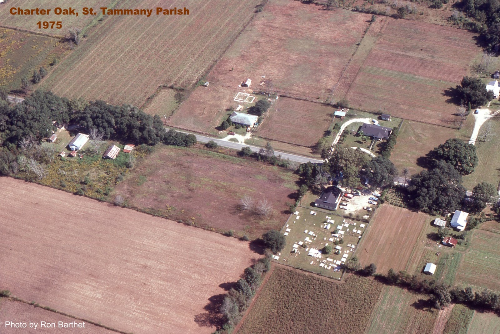
Charter Oak
Covington
The east entrance on Boston Street in 1975

Click on the images to make them larger.

Covington High 1976

1976


1972

Claiborne Hill 1975

Above photo from the La. Dept. of Transportation

Photos by Ron Barthet
Claiborne Hill Close Up

St. Paul's School

Parish Fairgrounds around 1975

Parish Fairgrounds around 1980

Below image shows the Parish Fairgrounds prior to 1980. Notice Lyon Elementary at the bottom, the baseball fields still on Columbia Street, the National Guard Armory on the corner, the Covington Community Center facing Columbia St. and the Holy Family Catholic Church on the extreme left edge.

Below is the view looking eastward at the Hwy. 25 and Collins Blvd. intersection in 1975. The big white building is Poole Lumber Co. The
picture is interesting for what it does not show, things that haven't
been built yet: the St. Tammany Parish Jail, the Winn Dixie Supermarket
and shopping center, the Shell Service Station, drug stores, Wendy's,
Burger King, McDonald's, with no residential subdivisions in the far
distance.

Click on the images to make them larger.


View looking westward on Interstate 12 (under construction) with U.S. 190 running horizontally across the frame, left side going to Mandeville. The Jet Drive In visible on the right.


Photos by Ron Barthet

Dorignac's Farms, Old Military Road, 1975

Evans Creek

Goodbee
View looking southwest at intersection of U.S. 190 and La. 1077, with the "Country Boy One-Stop" grocery store pictured.

Fairhaven Children's Home

Folsom
View looking northeast at the La. 25 and La. 40 intersection. The old town hall is located just above the intersection. It was later moved west one block to the gravel road in the lower lefthand corner.

The Broken R Ranch east of Folsom

Fontainebleau State Park

Fontainebleau Park looking towards causeway over lake

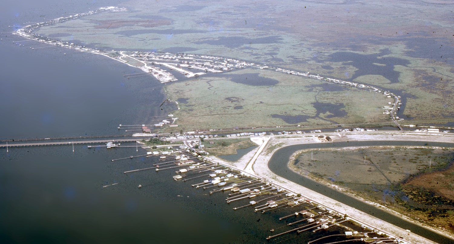
Goose Point


Hickory

Lacombe

Lacombe Marsh 1975

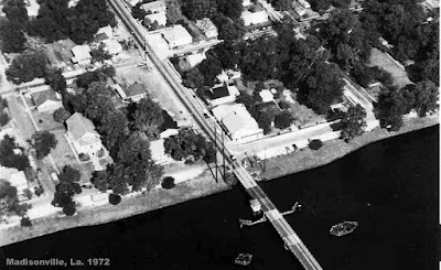
Madisonville
1972

Click on the images to make them larger.

The old community house can be seen in the above photo
1975

View looking southward towards Lake Pontchartrain


Close up

Wooden Boat Festival

Click on video below to see more boat festival pictures.
Marina Beau Chene

Beau Chene Golf Course

Mandeville
Mandeville Harbor

Click on the images to make them larger.

A little closer
Girod Street (back when it was Gerard St.)

View looking southward at U.S. 190 and Girod Street intersection in 1975. U.S. 190 runs horizontally across picture. Library in upper middle.

Mandeville Junior High

Prestressed Concrete Plant

La. 22 at North Causeway, K-Mart bottom right

Pearl River
Here
is an aerial photograph of Pearl River taken in 1975, with the view
looking west. Pearl River High School is seen in the lower center of the
picture. Click on the image to make it larger.

Downtown Pearl River 1975

Click on the images to make them larger.

Sixth Ward Junior High

A lock on the Pearl River Navigational Canal

Slidell
Gause Blvd. looking west from I-10 towards Front Street.

Front Street, view looking northward, with train depot near top of frame across from two-story red building (now the Chamber of Commerce).

View looking southward towards Gause Blvd., with the water tower and Slidell High School in upper right.

The Tiger Drive-In Movie Theater

Slidell Northshore
Carr Drive at top
The Village of Sun

Talisheek

Waldheim

Many of the above aerial photographs were taken with the help of Howard Estes, a local pilot who volunteered to take me up in the air to take pictures of St. Tammany Parish every so often. Click on the article below for details: