Saturday, May 7, 2022

Skater's Paradise 33 Years Ago

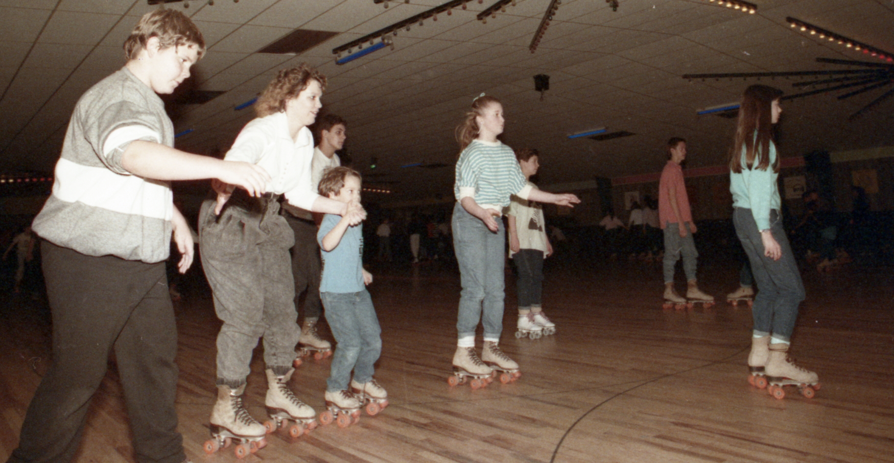
 Here are some photographs, taken 33 years ago, of people rounding the rink at Skater's Paradise in Slidell. These photos were taken in January of 1989. Click on the images to make them larger.


See also:

PDF File with All of the Skater's Paradise Pictures from 1989 

Skater's Paradise Slidell - 1989 Part Two

Skater's Paradise in Slidell 1989 - Part Three

Thursday, May 5, 2022

Don Dubuc Tells About Rivers

 Don Dubuc, area broadcaster who focuses on outdoor sports and fishing, was a guest speaker at the Folsom Scenic Rivers Art Festival Sunday afternoon. Dubuc has been talking about St. Tammany rivers, bayous and marshlands for over 30 years, on television, radio, and now even YouTube with his Bayou Wild channel.


In the 1970's Don Dubuc had a radio show on WARB radio station, Covington. Click on the image to make it larger.

He was introduced at the festival by Frank Richerand, owner of the Giddy Up Coffee Shop and Far Horizons Art Gallery. Dubuc talked about the changes he has seen over the years in St. Tammany. Click on the link below to hear his overview of St. Tammany waterways and their importance to the area. 

To hear Don's talk to the festival,
click on the play triangle below.

See also:

https://www.dontheoutdoorsguy.com/

https://www.youtube.com/watch?v=raR_eSXCTKM


Wednesday, May 4, 2022

Tourist Commission Brochure

 In its never ending quest to share visitor information about St. Tammany Parish, its healthy lifestyle, scenic rivers, rolling hills and great variety of parks, the St. Tammany Tourist Commission published this brochure a few decades ago. 


There's no date on it, but take into consideration these observations. 

Ozone Air was still being advertised, so this was before ozone was a bad word, and researchers had determined that it was actually terpene put out by pine trees that made the air so health-inducing. 

The citizens band radio channel 9 was mentioned as a source of help for motorists. Highland Park Hospital in Covington was among the medical facilities listed. The Saddlewood Horse Farm near Waldheim was in operation and hosting an annual horse show.

Among the hotels listed were Colby Inn, Bob's Motel, Holiday Inn (Covington), Mount Vernon Hotel, Ozone Motel (Mandeville), Ramada Inn, Scottish Inn and Star Motel. Campgrounds listed included Money Hill Plantation and Lake Ramsay. The list of golf courses included Pretty Acres Golf Club.


Click on the images to make them larger. 
For a really large view CLICK HERE


On the map DeLetes Bayou is labelled where Cane Bayou is today

For a really large view of this map, CLICK HERE

Unfortunately, they misspelled the word "pirogue."


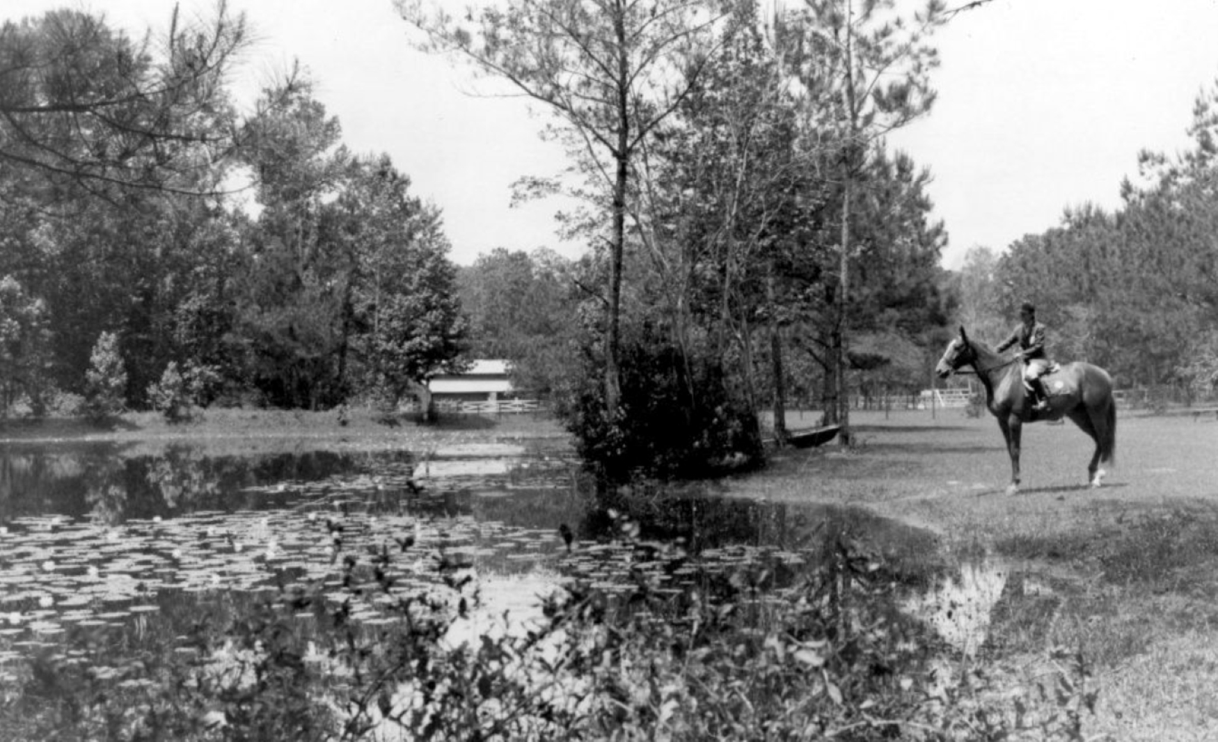
From the Louisiana Digital Archives, here is a photo of Saddlewood Farms, 1970s. The caption reads " This giant horse ranch, near Covington, Louisiana, is the home of the Louisiana State Equestrian Team, which has won several championships and honors over the years representing the state in horse shows and equestrian performances throughout the South. Interested riders from all over America came here to learn the fine points of riding from the Farm's master instructors, and shows are performed throughout the year which are open to the public."


Tuesday, May 3, 2022

Lions Club Brochure on St. Tammany - 1950's.

 In the early 1950's the Lions Clubs of Covington and Slidell got together and published a color brochure praising the attributes of St. Tammany Parish. It contained a wealth of information on the various topics of interest to visitors and newcomers. Here is what it looked like:


Click on the images to make them larger.


To make this image larger and more readable, CLICK HERE.

On the above map a community called "Bradley" was on U.S. 190 between Covington and Goodbee.

Here is the text found on the brochure:

Welcome to beautiful St. Tammany Parish, LA

Scenic Beauty

The beauty of St. Tammany Parish is the beauty of the forest, still largely primitive; of bayou and river that thread through vistas of semi-tropical foliage, carpets of grasses and moss draped oaks; of flowers and shrubs and palms that mingle in wild, colorful masses. Set in pleasing wooded areas are all of the Parish's population centers, and joining them are excellent paved and surfaced highways. Plant life in St. Tammany is semi-tropical. This enchanted land - simple, rustic, variegated, verdant through all the seasons, is fitted for practical as well as pleasing living. 

Agriculture

Superior location, mild climate, generous rainfall, and soils of great variety that respond to kind treatment, is a blueprint for assured success in St. Tammany Parish agriculture. A wide range of fruits and vegetables, including delicious strawberries, melons, satsumas, peaches, pears, come from the parish's 100,000 tilled acres, along with the grains, legumes, hays, grasses, cotton, yams, and the beef and dairy cattle, hogs, sheep, all types of poultry and horses that found out the picture of ideal general farming. 

Tung Industry

A gift to America from China is the magic tung not. It produces an oil of a thousand uses in industry. More than a decade ago the cultivation of the tung tree was ventured in St. Tammany Parish by a few daring pioneers. It quickly developed that her the tung is "at home."

Today, thousands of acres of highly productive tung groves are to be seen on the higher, better drained, red soil areas of the Parish. With the great demand for the oil in America, tung culture promises handsome rewards. Much land adapted to tung planting is still available in the parish at prices astonishingly low when the ultimate profit coming from intelligent development is considered. 

Churches

In St. Tammany's towns, villages and rural areas are churches for Catholic and Protestant congregations. Places of worship are readily available to even remotest rural dwellers. Church activities bring their benefits to all communities of the Parish. All denominations share in the activities that embrace parochial schools, Sunday schools, Bible schools, young people's societies, women's organizations, and the Boy and Girl Scouts organizations sponsored by the churches. 

Health and Climate

Research has developed that the air in this part of St. Tammany is similar to that existing in two other "Ozone" areas in the globe. One is in the Hartz mountains in Germany and the other is in Arizona. To such areas, on the advice of physicians, repair those suffering from maladies of the heart, the lungs and the respiratory system.

The vital statistics tell the story: the parish death rate 9.0 per 1000; Louisiana 10.0; United States 10.9. 

For better health, longevity, contented living - St. Tammany Parish, Louisiana. Characteristic of the Ozone Belt are splendid pine forests who towering, ever-singing trees give off a fragrant balm, and artesian waters of real purity and pleasing taste. There are also medicinal springs that yield waters acknowledged to have high therapeutic value. 

State Park

One mile from Mandeville, 10 miles from Covington, is one of America's great natural parks. Fontainebleau, once the palatial plantation dwelling of the Louisiana colonial cavalier Bernard Marigny de Mandeville. This park of some 5800 acres is just being developed into a recreational spot and wild life preserve, with facilities for visitors and vacationists. 

Banks...Homesteads

For home construction or business development, for trade or commerce, general farming, stock raising, manufacturing, for the small enterpriser or the war veterans seeking a new start in life. St. Tammany Banking and Homestead interests stand ready to serve with ample financial resources and co-operative assistance. 

There are building and loan associations and bank facilities in three centers. 

Industry

St. Tammany Parish is industrially active, progressive, alert. In  Slidell and Madisonville are shipyards where various types of the small craft are constructed. In Covington are two large plants where valuable products, such as tar, pitch, turpentine, and wood preservatives are recovered from the stumps, limbs and roots of the pine tree. In the parish are numerous sawmills and wood-working plants, a tung-nut crushery and oil extractor, and numerous smaller businesses enterprises.

Near New Orleans, the air-hub of the Americas, there are airports at Covington and Slidell. 

The parish has the raw materials for substantial industries in plastics, plywoods, fisheries, and clays. In Slidell are large plants that manufacture superior types of brick, tile and other building products.

Schools

Adequate schooling of the young is the public's solemn obligation. St. Tammany Parish has acted in Public Education's best traditions in providing elementary and high schools. Scattered throughout the parish are fourteen public and nine parochial grammar schools, and three public and three parochial high schools. A fleet of 33 modern steel buses places high school as well as grade school education within reach of every child in the parish. 

St. Tammany - The Land of Opportunity!

Covington

The parish seat of St. Tammany is a well-ordered, homey city of 4000 set on the banks of the Bogue Falaya, a clear water, sandy bottomed river, and treasured remnants of a once great virgin forest. 

Covington has splendid, friendly homes that stretch mile after mile along paved, shaded streets. Reflecting the satisfaction of the populace are floral gardens and trails who massed blooming at intervals creates dazzling, indescribable beauty.

Covington is situated on U. S. Route 190, La. 7, and La. 34, about 60 miles north of New Orleans. It is preferred by many Louisianians for restful vacation, for summer residence, for health and repose, for leisurely retirement and for its environment where all things combine to make life pleasant.

Covington is served by railroad and bus lines, is reached by navigable stream, is 8 miles from Lake Pontchartrain, and gives the sportsman and vacationist ready access to splendid hunting, fishing, boating, bathing, camping, motoring. 

In suburban Covington is a residential wonderland that has come to be admired all over America. Palatial dwellings, many with beautifully landscaped grounds, line the suburban roads for miles. The beautiful Bogue Falaya and Tchefuncta Rivers, where sandy-bottomed "swimmin' holes" are set in shady areas, bound Covington on two sides. 

Slidell

Gateway to New Orleans, Slidell is 11 feet above sea level and has a population of 3600. Deep waterways to the sea. Southern and G. M. & O. railroads, and Bus service augment travel facilities for its citizens and visitors. Jackson Highway, Mississippi Valley Scenic Highway, Appalachian Highway, and Colonial Highway all converge on Slidell over Old Spanish Trail 90. 

Two reinforced concrete bridges spanning Lake Pontchartrain at edge of Slidell connect the latter city with New Orleans, 30 miles distant. Average temperature in Slidell is 69.3 degrees; 54.5 for January, and 82.3 for July. 100 degrees - never. 32 degrees is rare. 

Slidell is St. Tammany Parish's easternmost town and has adequate grammar and high school facilities. Its churches serve all denominations.  

Industries include the largest continuous brick kilns in the South, a large creosote treating plant, agricultural lime crusher, (state-owned), and cattle, pulp woods, and pine timber. Dairy products and slaughter houses have been added during the past three years. 

For rest, recreation, and sport, Slidell and its environs offer fishing in lake, rivers and even bayous, swimming, sailing on Lake Pontchartrain, yachting, hunting in winter for ducks in marshes or deer and squirrels in Honey Island (nearby). Artesian water and ozone air combine to make life just a little more pleasant in Slidell. 

Covington or Slidell Lions Club Sponsors of this Brochure

Ode To K-Mart

On the occasion of the K-Mart being demolished in Mandeville
Gone is the blue light special,
The store known as K-Mart,
When Christmas season rolled around,
It's where we all would dart.
From the long lunch counter,
To the racks of shoes,
From the auto service center,
To fabric of many hues.
Nothing beat the wide array,
Garden center full of plants,
The hardware section with all its tools,
All the shirts and skirts and pants.
We will miss you K-mart,
You brought us lots of joy,
Popcorn, videos, health goods too,
And now and then a toy.
The balloons were great, the CD's cool,
The greeting cards were neat,
The memory of shopping with our friends,
At K-mart can't be beat.
As you go to retail heaven,
And the sweet buy and buy,
Say hello to our old friends,
Especially TG&Y.


K-Mart being demolished, December 2019 (Photo by Henry Beck)

Monday, May 2, 2022

Music, Art, and Good Things To Eat

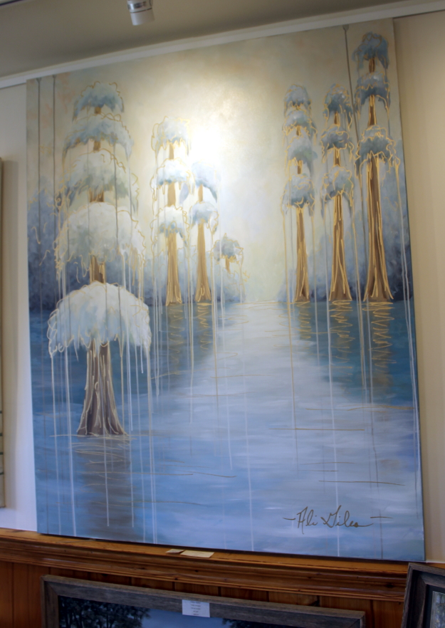
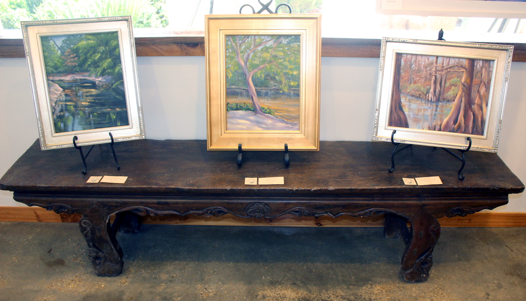
The Far Horizons Art Gallery in Folsom hosted its second annual Folsom Scenic Rivers Art Festival Sunday, May 1, 2022, with a number of original artworks on display by artists who work in all kinds of media: painting, drawing, photography, ceramics, sculpture, pottery, fine jewelry, handmade clothing and accessories and more.


Click on the images to make them larger. 

Hundreds of people showed up for the event, and owner Frank Richerand emceed the  musical performances. He also introduced two guest speakers, David Campbell with the Little Tchefuncte River Association and Don Dubuc, a local sports and outdoors broadcaster. Campbell spoke on the recent river clean up activities, and Dubuc shared information on the rich variety of bayous and rivers that course through St. Tammany Parish. They were invited to share their knowledge in connection with the Folsom Scenic Rivers Art Festival theme.


Frank Richerand with Don Dubuc, left, and David Campbell, right 

The Giddy Up Paddock area behind the Giddy Up Coffee House showcased music by the Brass Hearts Brass Band, a group of young musicians that has earned a great reputation for great music. They have appeared at the Paddock stage a number of times. 

The Scenic Rivers Art Festival supports and encourages art education for area school children, providing hands-on art activities and children’s entertainment. The Far Horizons gallery is located at 82286 La. Hwy. 25 in Folsom, next to the Giddy Up Coffee Shop. 

Here are additional photographs of the goings-on:

The gallery


The visiting artists


Suzanne King, the Poster Artist


Richerand announces the first festival poster


Special guests included Parish President Mike Cooper (2nd from left)

The music performances


The food


Several vendor tents encircled the audience area


Aunt Decie's Library was open for review


And a good time was had by all


Sunday, May 1, 2022

All Roads Led To Madisonville

 This 1863 map shows St. Tammany Parish and neighboring areas with key connecting roads. Click on the image to make it larger. 


Commentary: 

In the top left is Holmesville, Mississippi, a key community at the time and a hub of political influence. The railroad passed it by however, and it barely exists today. The road east to Columbia, Ms, is shown, but Tylertown hadn't made it on the scene yet. 

The road between Holmesville down to Covington was a major trade route, supplying Covington with key produce and foodstuffs.  On some early maps of Covington, Columbia Street is actually labelled as "Holmesville Road" in the area of the parish fairgrounds. A 1927 map of the area showed La. Hwy. 25 in front of St. Gertrude's Convent as The Holmesville Road. The goods from Mississippi were shipped by schooner and steamer from Covington and Madisonville down the Bogue Falaya and Tchefuncte Rivers across Lake Pontchartrain to New Orleans. 

Turnpike Road heading northwest out of Madisonville was a well-travelled route at the time, and a road west towards Baton Rouge (now La. 22) was part of the early Spanish "King's Highway." The road heading east out of Madisonville only went to Lewisburg and Mandeville. From Covington the main road going eastward through Hickory across the Pearl River to Gainesville, Mississippi, seemed to be a major corridor. Abita Springs at the time wasn't big enough to be on the map. 

From Gainesville the road continued on to Shieldsboro, which is today called Bay St. Louis. From Shieldsboro two roads headed southwestward, one going to Pearlington and the other hugging the coast and going across Pearl River Island just east of the Rigolets. That southern route would later become the route of the railroad tracks. The highway between Pearlington and the Rigolets would not be built until the late 1920's.

Of some interest is the road coming from Columbia, MS. (top, center), down to Fordeville, where Ford's Fort (The Ford Home) is located. It is now Sandy Hook, Ms.  In 1814, this location played a part in Andrew Jackson's travels from Tennessee to New Orleans to take part in (and win) the Battle of New Orleans. 

Although this map was made 50 years after he passed through, it may show the general track of the route he took southward, passing just west of Bogalusa, across the Bogue Chitto River at Isabel and into St. Tammany Parish, down Old Military Road (La. Hwy. 1082), then along Military Road (La. Hwy. 21) into Covington. Research is now being done to pinpoint Jackson's route because of its historic significance.

From Covington he went to Madisonville and took a boat across Lake Pontchartrain where he joined a large group of volunteers and engaged the British in the The Battle of New Orleans at Chalmette Battlefield, now a national historical park. 

The Darby Map

An earlier map, the Darby Map of 1816, is more concurrent with Jackson's trip. Here it is. 


Click on the map to make it larger

The pink fringed areas are Mississippi, and at this time St. Tammany extended all the way from Lake Pontchartrain northward to Mississippi. Washington Parish had not yet been created. The initials "C.H." in the middle of the map stand for courthouse and indicates where the parish courthouse was when it was located near Enon. This map was made only three years after Covington was founded, and the new town wasn't yet big enough to put on the map. Jack Terry sent me this map following up on our discussions on the 1814 Jackson trip. 

Vivian Davis Borneman of Lacombe wrote extensively on the early roads in Louisiana, and her information on roads which were in use in 1816 is  an important resource for historians. 

She quotes William Darby, who made a survey of roads in Louisiana in 1816, about the possible route of the well-used "Post Road," which was extended in 1803 (the year of the Louisiana Purchase) from the Natchez Trace to Madisonville, Louisiana.

Here is an excerpt of her report:

"The Road from Washington, D.C., to New Orleans- A Post Road from Washington, D.C. to Nashville, TN, had existed prior to 1801. It was extended to Natchez (MS) in 1801 and was called The Natchez Trace.

"When we bought Louisiana from France in 1803, and Governor Claiborne took over in Louisiana, he somehow induced the Spaniards to let him extend this post road from Natchez, through their Spanish West Florida territory to New Orleans..."

She explained that General Wilkinson's road (as it was known in 1823) went from Pearl River westward across St. Tammany and St. Helena Parishes (Tangipahoa Parish didn't exist as of yet), and then onward to Baton Rouge. 

Another major road (the possible Post Road) ran from Natchez down to St. Francisville, then headed southeastward on a diagonal path past the top of Lake Maurepas and headed across the Tangipahoa River straight into Madisonville. "Here, a person took a packet across Lake Pontchartrain and into New Orleans," she stated.

"At Madisonville, a road leads almost directly north, past Horton's Mill, on straight northward to the St. Tammany Courthouse (at that time owned by Robert Lobdell), and then headed northeast to Pearl River. (The Pearl River was used a great deal for traffic.) This road (in Madisonville) was on the east side of the Tchifonta River." 

Her conclusion was as follows:

"The Road from Washington, D.C., to Madisonville, as shown herein, was complete and in use in 1816... Mr. Darby's survey in 1816 does not show General Jackson's Road into Madisonville (known to be in use in 1823). In 1806 Judge Toulmin, at Fort Stoddert, AL, put a Post Road through to Madisonville. 


Fort Stoddert was about 30 miles due north of Mobile, AL

"From Pearl River, the route established by him in 1806 is identical with General Jackson's Road into Madisonville (as shown on an 1823 Bulletin). This was the post road into Madisonville, from Ft. Stoddert in 1806, and it was in use in 1827." 

She also mentioned that Darby's 1816 map, while it does show a few short roads around Baton Rouge, it also shows the one going (all the way) into Madisonville, where a ferry would be taken over the lake into New Orleans.

See also: