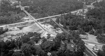
Here's an aerial photograph of Claiborne Hill intersection in 1975, forty-one years ago. The first image below is the photograph with no labels, and the second photograph is the same, but with labels showing where things used to be and also what is there today. To see a larger image, click on the picture.
Thanks to Renee Kientz with the St. Tammany Parish Tourist and Convention Commission for help in finding this and other photographs I took back in 1975.
Claiborne Hill 2025 Google Maps 3-D View
Click on the above image for a slow panorama video of Claiborne Hill in the 1970's.


